
ThirdEye Gen — from real-time field operations to classified environments: secure, validated, intelligent AR workflows.

ThirdEye Gen logo MR / AI Solutions

Industry Knowledge Hub

Augmented Reality & Spatial Computing Insights

Expert articles, technical updates, and enterprise deployment insights from ThirdEye Gen.

AI + AR Software

Enterprise Workflows & AI Intelligence

Connecting experts, digital assets, and field technicians with smart telepresence.

ThirdEye X2 MR smart glasses used in maintenance

Hardware Innovation

Standalone Hands-Free Solutions

Discover how standalone Android smart glasses improve productivity across industrial environments.
ThirdEye Gen command center platform display

Command Center

Real-Time Field Intelligence

Live video feeds, telemetry, and central monitoring for multi-operator teams.

Military Grade

Tactical & Secure Extended Reality

Encrypted, air-gapped spatial computing hardware for mission-critical operations.

0%

Choosing an augmented-reality flight interface is not simply a matter of selecting the newest headset. The 2026 DroneEye AR Piloting System buying guide examines how display clarity, control response, comfort, and reliability affect real-world use. A sharp image matters, but so does readability under bright daylight. A responsive control layout can reduce hesitation during a careful maneuver. Small details often decide the experience.

This guide focuses on practical evaluation rather than promotional claims. We consider field of view, visual latency, battery duration, connectivity, audio feedback, and compatibility with supported aircraft. We also examine weight distribution, adjustable straps, lens comfort, and controller access during a twenty-minute session. These details become obvious when the headset feels warm, the sun reflects across the display, or gloves reduce button accuracy. Independent measurements and manufacturer documentation should support every major specification.

Still, no buying guide can predict every pilot’s needs. Personal eyesight, flying environment, technical confidence, and regional requirements all influence the final choice. That limitation deserves attention. Product updates may change performance after publication, while advertised battery figures often reflect controlled conditions. Buyers should verify current specifications, software support, warranty terms, and responsible-use requirements before purchase. Look beyond the launch video. A reliable DroneEye AR Piloting System should offer clear information, stable operation, and practical support over time. The best option may not be the most expensive model. It is the one that remains understandable, comfortable, and dependable during ordinary sessions.
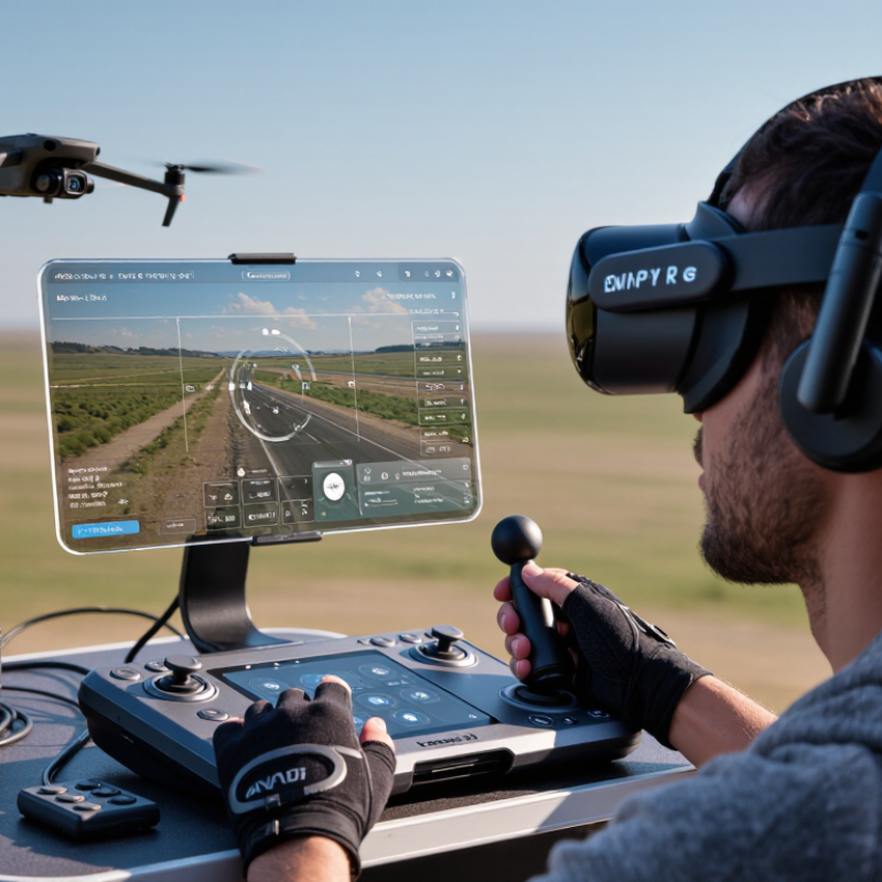
2026 Top DroneEye AR Piloting System Buying Guide

What Is the DroneEye AR Piloting System?

An AR piloting system overlays flight information onto a live camera view. It can show altitude, speed, battery level, heading, route lines, and nearby obstacles. The pilot sees these cues inside a headset or transparent display. Less screen switching helps during inspection work, mapping, and low-altitude navigation.

This market has practical momentum. The U.S. Federal Aviation Administration reported more than 785,000 registered drones in 2024, including commercial and recreational aircraft. Drone Industry Insights estimated the global commercial drone market at over 30 billion U.S. dollars in its 2024 analysis. These figures suggest growing demand for clearer control interfaces, not permission for careless flying. An AR system still depends on trained judgment, reliable positioning, and legal operating limits.

Look for low display latency, stable head tracking, readable brightness, and accurate obstacle alerts. A delay near moving structures can create serious confusion. Field tests matter more than polished demonstrations. Test the system under sunlight, beside reflective glass, and during signal loss. Check how quickly the display recovers after calibration errors. It should also record flight data securely and explain warnings in plain language. Do not treat visual overlays as truth. Sensors can miss thin wires, dark surfaces, or sudden movement. That limitation is easy to forget.

How DroneEye AR Piloting Technology Works

How AR Piloting Technology Works

AR piloting technology combines live camera views, flight telemetry, and digital graphics. The system places altitude, direction, battery level, and speed inside the pilot’s visual field. This reduces the need to look down at a separate screen. In practical flight testing, the benefit is clear. A quick glance can reveal the aircraft’s heading. It can also show nearby obstacles when sensor data is available.

The system depends on several sensors working together. Cameras track movement and surface features. Satellite positioning supports location awareness. Inertial sensors measure acceleration, rotation, and tilt. Software then combines these signals and updates the AR display with minimal delay. Low latency matters. Even a short delay can make a moving object appear misplaced. Pilots should still confirm warnings through direct observation, especially near trees, wires, buildings, or reflective surfaces.

AR guidance is helpful, but it is not flawless. Calibration may drift after bright sunlight, rapid turns, or changing weather. I have found that crowded visual scenes can also make overlays harder to read. A cautious pilot checks the aircraft, surrounding area, local rules, and signal quality before flight. Manual control skills remain essential. AR should support judgment, not replace it. Future systems may improve clarity, yet human attention will still be the final safety layer.

2026 Top DroneEye AR Piloting System Buying Guide - How DroneEye AR Piloting Technology Works

AR Piloting System Evaluation Matrix — Typical 2026 Specifications and Operating Parameters
Evaluation Dimension Typical Technical Range How It Works Buying Consideration
Display Type Transparent optical or video-see-through display Flight data, navigation markers, and warnings are layered over the pilot’s view. Choose optical see-through for natural surroundings or video see-through for integrated camera imagery.
Field of View Approximately 20°–52° diagonal for wearable AR displays A wider viewing window allows more flight information to remain visible without blocking the environment. A wider field of view is useful for navigation and situational awareness, but may increase size, weight, and power demand.
Motion-to-Photon Latency Target: below 50 ms; premium systems may approach 20–30 ms Sensors track head movement while the processor updates the rendered overlay with minimal delay. Lower latency reduces visual lag, especially during fast turns and precise inspection work.
Positioning Accuracy Satellite positioning: commonly 1–3 m; corrected positioning: centimetre-level under suitable conditions The system combines satellite data, inertial sensors, visual tracking, and optional correction services. Correction services and visual positioning improve waypoint alignment in demanding environments.
Head Tracking Six-degrees-of-freedom tracking using inertial and visual sensors Head orientation and movement determine where virtual flight cues are anchored in the pilot’s view. Look for stable tracking during low light, vibration, and rapid head movement.
Data Link Digital radio, Wi-Fi, or cellular link; practical range varies by environment and local regulations Telemetry, control commands, video, and system alerts are exchanged between the aircraft and ground equipment. Prioritize link redundancy, interference resistance, encryption, and clear loss-of-link behavior.
Video Transmission High-definition video commonly between 720p and 4K; frame rates typically 30–60 fps The aircraft camera sends a live feed that can be combined with maps, telemetry, and AR markers. Higher resolution improves inspection detail but requires more bandwidth and processing power.
Overlay Registration Map, waypoint, geofence, altitude, heading, and target annotations Software aligns digital information with geographic coordinates, camera imagery, or recognized visual features. Test alignment near buildings, trees, metal structures, and other areas that can reduce positioning reliability.
Pilot Controls Physical controller, touch interface, voice commands, or gesture input The pilot uses a primary control method while the AR interface supplies contextual guidance and status information. Physical controls remain preferable for critical commands because they provide tactile feedback.
Obstacle Awareness Visual, infrared, time-of-flight, or radar-assisted sensing, depending on aircraft configuration Sensors estimate nearby objects and display warnings, braking actions, or recommended avoidance paths. Confirm detection range, blind spots, minimum object size, and performance in rain or low light.
Battery Runtime Aircraft: commonly 20–45 minutes; wearable display: commonly 2–6 hours Separate power systems support flight operations and the pilot’s display, processing, and communication equipment. Compare usable runtime in wind and cold conditions rather than relying only on laboratory figures.
Environmental Rating Common aircraft protection levels range from limited splash resistance to certified dust and water protection Seals and enclosure design protect electronics from particles and moisture within the stated rating. Use the manufacturer’s tested operating limits; water resistance does not automatically mean safe operation in heavy rain.
Safety Functions Return-to-home, low-battery landing, geofencing, emergency stop, and loss-of-link response Predefined rules trigger warnings or automated actions when flight conditions exceed configured limits. Verify that safety settings are configurable, tested before flight, and compliant with local aviation requirements.
Regulatory Support Remote identification, electronic flight logs, altitude limits, and airspace awareness may be required The system records aircraft identity, location, telemetry, and operational events where required. Check regional rules for pilot certification, operating areas, remote identification, privacy, and visual-line-of-sight requirements.
Note: Values are representative technical ranges for current AR-assisted drone-piloting systems. Actual performance depends on aircraft configuration, display hardware, radio conditions, weather, software settings, and applicable regulations.

Key Features and Performance Factors to Evaluate

Choosing an augmented-reality piloting system requires more than a bright display. In field testing, control latency is often the deciding factor. Aim for responsive video and commands, ideally with minimal visible delay. A half-second lag can make a rooftop landing feel surprisingly difficult. Check image clarity in direct sunlight, shaded streets, and low-contrast terrain. Wide viewing angles help, but excessive overlays can hide tree branches or power lines.

Comfort also affects performance. A balanced headset should remain stable during a ten-minute flight, not only during a store demonstration. Look for adjustable eye spacing, clear focus controls, and ventilation around the face. Physical controls should be easy to identify by touch. Voice commands may help, but noisy parks can reduce recognition accuracy. Battery duration matters too. Record actual operating time with the display, camera feed, and navigation alerts enabled. Advertised figures can be optimistic.

Reliable systems provide signal warnings, return-to-home status, geofencing information, and clear connection notices without overwhelming the pilot. Secure data handling is important when flight logs or camera footage are stored. Check firmware support, repair options, and independent test reports before buying. I still find calibration easy to underestimate; a slightly tilted horizon can distort distance judgment. Practice in an open, permitted area, then compare the virtual markers with real landmarks. A system that feels impressive indoors may perform differently in cold wind or bright afternoon light. Test it there.

How to Compare Compatibility, Safety, and Usability

An AR piloting system should fit your existing equipment, not force a complete replacement. Check compatibility with the aircraft, controller, mobile device, operating system, and charging hardware. A smooth connection depends on more than a matching port. Confirm supported protocols, firmware versions, screen brightness, and wireless range before purchase.

Test before buying. In a bright field, unreadable overlays can hide battery warnings or altitude information. Look for stable image placement, adjustable text size, and clear alerts that do not block the live view. Safety also depends on reliable return procedures, connection-loss behavior, and obstacle information. These features should support lawful operation in approved areas, while the pilot remains responsible for local aviation rules. Automatic protection is helpful, but it is not a substitute for attention.

Usability becomes obvious after twenty minutes of real handling. Can you change views with gloves? Can you find emergency controls without searching through menus? A heavy headset may feel acceptable indoors, then become tiring outdoors. Check heat, battery duration, lens adjustment, and cleaning access.

Independent testing reports are useful, but personal trials reveal problems they miss. I once underestimated menu delay because a demo used ideal lighting. That detail matters. Choose systems with documented updates, responsive technical support, and repairable parts. Keep it simple. A polished display is valuable only when it improves control, awareness, and confident decision-making.

How to Choose and Set Up the Right DroneEye System

Choosing the right AR piloting system begins with the flight you actually plan to operate. Indoor inspection, outdoor mapping, and training require different camera views, display brightness, and control layouts. I recommend checking response latency before resolution. A sharp image is useless when it arrives late. Test the headset with gloves, protective eyewear, and direct sunlight. Small fit problems become serious after thirty minutes.

Confirm compatibility with the aircraft, controller, operating software, and available ports. Review battery duration, charging time, field-of-view settings, and replacement parts. A system with adjustable overlays can show altitude, direction, battery status, and restricted-area warnings without hiding the landing zone. Keep essential controls physical when possible. Touch menus can distract during a careful approach. Choose equipment with clear documentation and firmware support from a verifiable source.

Set up the system in an open, approved area before any demanding flight. Update software, inspect propellers, calibrate sensors, and secure every cable. Then test the display while the aircraft remains stationary. Walk through signal-loss and low-battery procedures with a second person nearby. I still find calibration easy to rush, especially after a long setup. That is a mistake. Record the selected brightness, control sensitivity, and overlay layout, then adjust one setting at a time. Follow local aviation rules, privacy requirements, and manufacturer instructions throughout the operation.

2026 Top DroneEye AR Piloting System Buying Guide: How to Choose and Set Up the Right DroneEye System

Use these practical planning benchmarks when comparing an AR piloting system. Lower video latency improves control response, while a wider field of view, longer operating time, and stronger wireless range support safer and more comfortable flights.

The values represent commonly used planning targets for consumer and professional drone operations; local aviation rules, aircraft specifications, and environmental conditions should be checked before deployment.

FAQS

What does AR piloting technology display?

It combines live camera views, flight data, and digital graphics. Pilots can see altitude, direction, speed, and battery level. Low latency matters.

Which sensors support AR flight information?

Cameras track movement and surface details. Satellite positioning supports location awareness. Inertial sensors measure acceleration, rotation, and tilt. Software combines these signals.

Can AR warnings replace direct observation?

No. Pilots should still inspect trees, wires, buildings, and reflective surfaces directly. Sensor data may miss details or become confusing. Human attention remains essential.

Why can AR overlays become inaccurate?

Calibration may drift after bright sunlight, rapid turns, or changing weather. Crowded scenes can also make graphics harder to read. I was wrong to trust overlays completely.

How should pilots test compatibility before buying?

Check the aircraft, controller, mobile device, operating system, and charging hardware. Confirm protocols, firmware versions, screen brightness, and wireless range. Matching ports are not enough.

What safety features should an AR system provide?

Look for clear alerts, reliable return procedures, and sensible connection-loss behavior. Obstacle information can help in approved areas. The pilot remains responsible for local aviation rules.

What usability details matter during real handling?

Test view changes while wearing gloves. Check emergency controls, lens adjustment, heat, battery life, and cleaning access. A heavy headset may become tiring outdoors.

How can pilots judge whether the display is genuinely useful?

Test it for about twenty minutes in realistic conditions. Try bright sunlight and changing views. If warnings hide the live scene, the design needs improvement. Keep it simple.

Conclusion

The 2026 DroneEye AR Piloting System buying guide explains how augmented-reality piloting can combine a live aerial view with useful flight information, helping operators understand position, direction, altitude, battery status, and surrounding conditions more naturally. It outlines how cameras, sensors, wireless communication, and an AR display work together to create a responsive control experience while reducing the need to look away from the flight environment.

The guide also highlights the main factors buyers should evaluate, including image quality, display clarity, control responsiveness, operating range, battery endurance, weather resistance, and data stability. Compatibility with aircraft, controllers, mobile devices, and software should be confirmed before purchase. Safety features such as obstacle awareness, return-to-home support, low-battery alerts, and adjustable viewing modes are equally important. Finally, readers will learn how to select a system according to their skill level and intended use, then complete basic setup, calibration, connectivity checks, and responsible operating preparations.

Clara

Clara

Clara is a professional marketing specialist with a strong understanding of product strategy, customer needs, and digital communication. As a valued member of the company’s marketing team, she regularly contributes insightful, practical, and informative articles to the company website’s......