
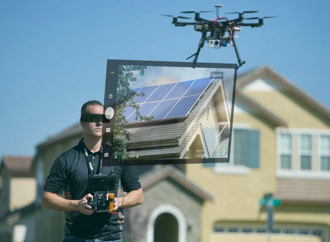
Real-Time Flight Avionics HUD
Visualise airspeed, altitude, battery reserves, GPS waypoints, and pitch/roll telemetry in an augmented reality overlay, allowing pilots to keep their eyes on the aircraft at all times.
ThirdEye Gen — from real-time field operations to classified environments: secure, validated, intelligent AR workflows.
AR Drone Software Platform
Real-time UAV flight telemetry, multi-spectral video streams, and spatial AI overlays projected directly into the operator's line of sight.
Next-Generation UAV Navigation
DroneEye by ThirdEye Gen bridges the gap between physical UAV flight and real-time digital intelligence. By projecting critical flight avionics, thermal video streams, and geographic waypoints directly onto the transparent display of ThirdEye X2 MR Smart Glasses, pilots maintain continuous Visual Line-of-Sight (VLOS) with the aircraft while inspecting complex environments.
Designed for defense programs, public safety units, and industrial infrastructure MRO teams, DroneEye removes the cognitive fatigue and safety risks associated with traditional handheld tablets or monitors.
Core System Features
Field-proven software architecture delivering situational awareness across search and rescue, critical infrastructure MRO, and defense reconnaissance missions.
Visualise airspeed, altitude, battery reserves, GPS waypoints, and pitch/roll telemetry in an augmented reality overlay, allowing pilots to keep their eyes on the aircraft at all times.
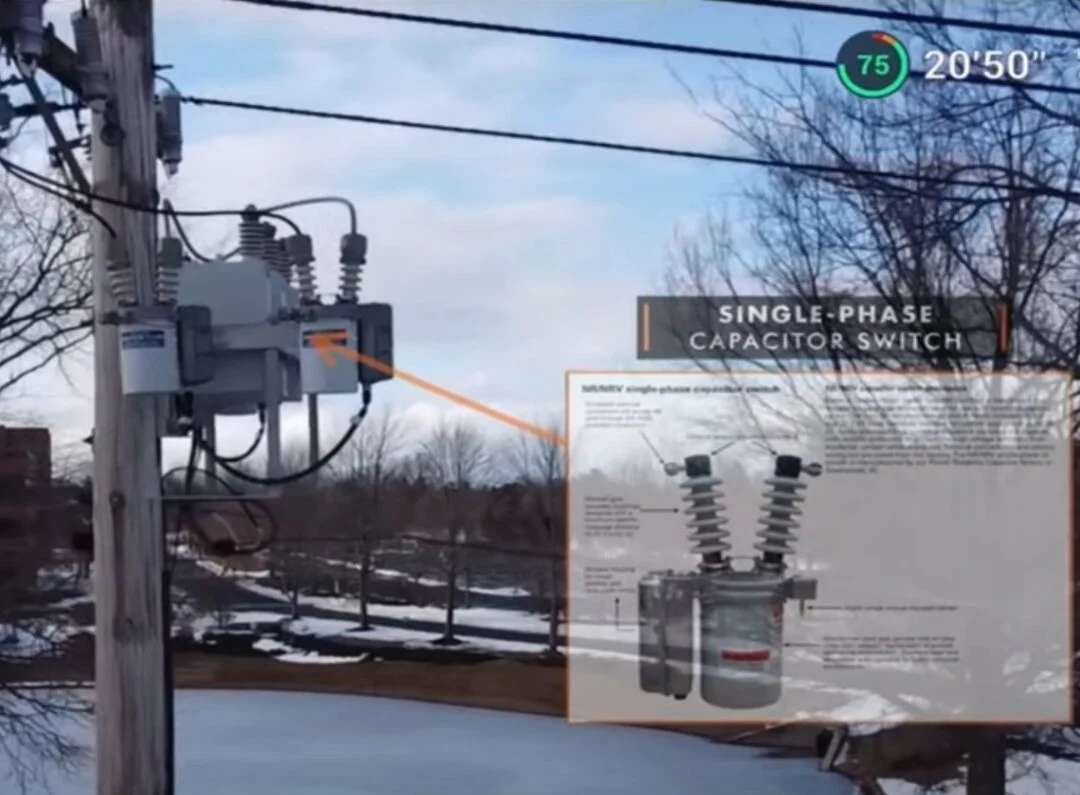
On-board neural networks highlight critical assets, machinery defects, vehicle identification numbers, or perimeter anomalies directly on the live camera stream in real time.
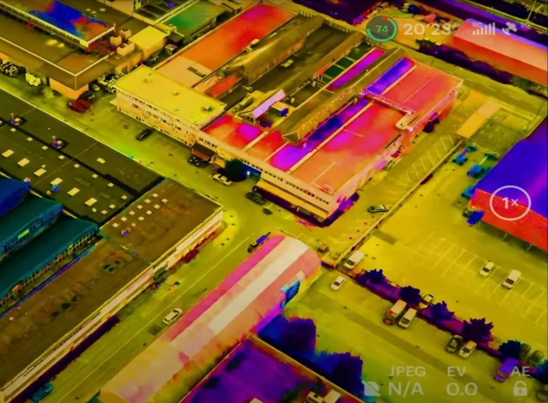
Stream thermal imagery from aerial payloads directly into the operator's line of sight to identify heat leaks, locate survivors in smoke or low-visibility terrain, and monitor power infrastructure.
Enterprise Interoperability
DroneEye operates as an extensible AR visualization layer for commercial and military drone fleets. Built on an Android-based open framework, integrators can easily link custom payload controls, sensor telemetry, and GIS mapping directly into the smart glasses HUD.
Procurement FAQ
Answers to common questions from commercial operators, defense procurement leads, and technology integrators.
DroneEye is ThirdEye Gen's specialized AR platform for drone operators. It transforms the piloting experience by delivering real-time flight telemetry, GPS data, and high-definition live video feeds directly into the pilot's field of view via ThirdEye X2 MR Smart Glasses. This provides a true Heads-Up Display (HUD) that allows pilots to maintain constant visual line-of-sight (VLOS) with the aircraft while simultaneously monitoring critical mission data.
By overlaying critical telemetry—such as altitude, airspeed, battery life, and gimbal orientation—directly onto the real world, DroneEye eliminates the need for pilots to look down at a handheld controller or tablet. This hands-free HUD keeps the pilot's focus on the environment, reducing cognitive load and significantly increasing safety during complex search and rescue, infrastructure inspection, or tactical defense missions.
Yes. DroneEye is designed as a hardware-agnostic AR visualization layer that integrates with major commercial and tactical drone platforms. It supports live streaming and data telemetry from DJI, Parrot, and various MAVLink-compatible drones, providing a seamless AR command and control interface for professional pilots across industries.
DroneEye is primarily deployed in high-stakes environments including emergency response (locating survivors via thermal drone feeds), utility inspections (identifying equipment defects on power lines), public safety (tactical surveillance), and defense reconnaissance.
Deploy DroneEye AR
Speak with a ThirdEye Gen solutions engineer to discuss platform integration, trial units, or custom software customization for your enterprise drone fleet.